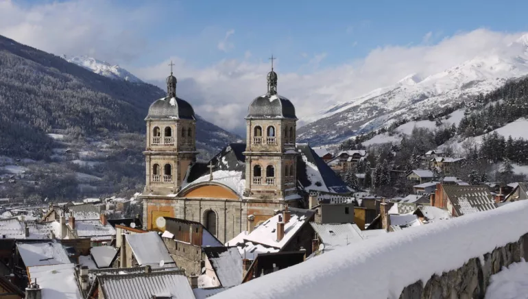
Briançon, City Vauban
Briançon, star of the valleys Located at the convergence of five valleys - Haute-Durance, Guisane, Clarée, Ayes and Cerveyrette - the town of Briançon occupies a remarkable geographical position.
The radiating structure of the valleys offered the town very early on relatively easy external access: to Provence, the Queyras, Isère, Drôme andmodern-day Italy. This dense network of communications has long made Briançon appear to be a land of passage, an important crossroads in the heart of the Alpine massif, offering the best conditions for the movement of people, the traffic of goods and the exchange of cultures.
Prehistory and Antiquity
Successive periods of glaciation in the Paleolithic period made it impossible for humans to settle. It is only during the Neolithic period that the presence of humans is assumed in the Briançonnais valleys. It is however certain during the Bronze and Iron Ages. The various peoples, first Ligurian, then Celto-Ligurian, lived on the flatness of the valleys and drew their resources from agriculture and trade. In the early days of Romanisation, Brigantio seems to have been established in the area of the present Champ de Mars. Briançonnais remained under Roman rule until the fall of the Roman Empire in the 5th century.
Briançon is located in the Dauphiné, a region which today corresponds to the departments of Isère, Drôme, and Hautes-Alpes.
This province was created around Albon, near Vienne in Isère, under the authority of a wealthy family whose members took the name Dauphins in the
early 13th century. In 1343, the inhabitants of the region, grouped into 51 communities, signed a charter with Humbert II, the last Dauphin, guaranteeing them freedoms and granting them privileges. In 1349, Humbert II
ceded his territory to the king of France. From this date onwards, the heir son of the reigning king bore the title of Dauphin du Viennois.
Briançon prey to fire
The dense urban fabric and the use of wood as the main building material are factors that make Briançon particularly vulnerable to fire. It was especially in the 17th century that the town suffered most cruelly from flames. The first fire broke out in December 1624 and destroyed four fifths of the town. In January 1692, the houses that had just been rebuilt were again reduced to ashes. The inhabitants rebuilt their houses on the previous foundations, so the old medieval plot of land remained virtually unchanged, but the appearance of the houses changed, with wood giving way to stone.
Vauban arrived in Briançon in the autumn of 1692 following a major attack by the Duke of Savoy. He found the site difficult to develop as it was surrounded on all sides by towering heights. On 21 and 22 November 1692, he drew up his project. He asked for the construction of bastions, half-moons and a false bay on the Embrun front. He prescribed various improvements: deepening the ditches, consolidating the curtains, placing guardhouses, making embrasures, crossings and posterns, vaulting the gate, building powder magazines, barracks and deepening the well in the Place d'Armes. During his second trip to Briançon, Vauban inspected the work and wrote a new memorandum, dated 24 August 1700.
Briançon, guardian of the frontiers
The end of the reign of Louis XIV was marked by the War of Spanish Succession, from 1701 to 1714. The Briançon region became the scene of Franco-Savoyard confrontations. In 1713, the Treaty of Utrecht put a partial end to the conflict, but it proved disastrous for the territory. The border, until then located well beyond the mountains, was moved to the Montgenèvre pass. France
lost the Val Cluson, the Varaïta and part of the Val de Suse, and received the Ubaye in exchange. The town then became a border area, the construction
of a real barrier of forts began under the Regency, in July 1721, and continued for thirteen summers under the reign of Louis XV.
Expansion in the 19th and 20th centuries
The organisation of Briançon underwent a major upheaval in the 19th century. The establishment of the Schappe factory in 1863, the arrival of the train in 1884 and the construction of new barracks from 1890 began the development of a new district near the Durance, around the hamlet of Sainte-Catherine. The post-war period saw unprecedented landscape changes. Traditional agricultural activities gave way to tourism and air conditioning. New practices of space correspond to a new landscape: the rural landscape is succeeded by the urban landscape.
Kenmerken
Fietsgarage Geen
Lunchpakket Geen
Elektrische fiets oplader Geen
Dit etablissement biedt specifieke diensten voor fietsers
Contact par mail
* Verplichte velden

