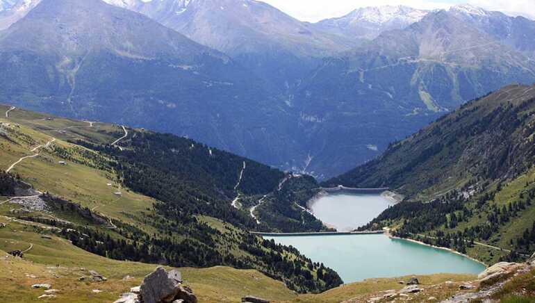
Dams of Plan d'Amont and Plan d'Aval
Built between 1945 and 1956, these two dams are built into the Hydroelectric Complex Haute-Maurienne and participate in particular filling the reservoir of Mont Cenis. They are located near the National Park of the Vanoise.
Fed by mountain torrents, the Plan d'Amont and Plan d'Aval dams ensure the operation of the valley's power stations.Plan d'Amont dam: this is a concrete gravity dam, 350 m long, made up of cells and buttresses, supported on the glacial lock which obstructs the valley. It holds 8,000,000 m3 of water, twice the volume of the Plan d'Aval, and collects all the water from the Saint-Benoît, thus capturing the catchment basin delimited by the Rateau d'Aussois, the Col de la Masse, the Pointe de l'Echelle, the Col d'Aussois, the Pointe de Labby and the western buttresses of the Dent Parrachée.
The water is turbined in a small power station called "Plan d'Aval", hidden at its foot, at the bottom of the talweg, before being discharged into the Plan d'Aval reservoir.
They are also an opportunity for a nice walk or a nice fishing trip. Public domain
Caractéristiques
Garage à vélo Non
Panier repas Non
Recharge VAE Non
Dit etablissement biedt specifieke diensten voor fietsers
Contact par mail
* Verplichte velden
